Trail Walking Les Bondons - Autour de Ruas - Photo
 tracegps
tracegps

User

© OpenStreetMap contributors
Length
Length
6 km
Max alt
Max alt
1034 m
Uphill gradient
Uphill gradient
323 m
Km-Effort
Km-Effort  
10.3 km
Min alt
Min alt
713 m
Downhill gradient
Downhill gradient
321 m
Boucle
Boucle
Yes
Creation date :
2014-12-10 00:00:00.0
Updated on :
2014-12-10 00:00:00.0

(1 Reviews)

Walking
Walking
2h00
Difficulty : Medium

Scan this QR Code to open this trail in the SityTrail application

FREE GPS app for hiking

Logo SityTrail SityTrail

IGN / Geographical institutes

Download SityTrail from the App Store Download SityTrail from Google Play

Logo SityTrail SityTrail World

The world is yours!

Download SityTrail from the App Store Download SityTrail from Google Play Download SityTrail on Huawei AppGallery

About

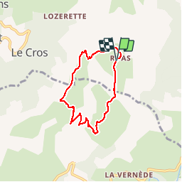
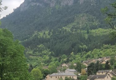
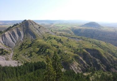
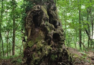
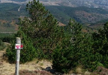
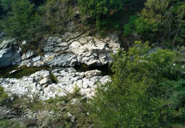
Trail Walking of 6 km to be discovered at Occitania, Lozère, Les Bondons. This trail is proposed by tracegps.

Description

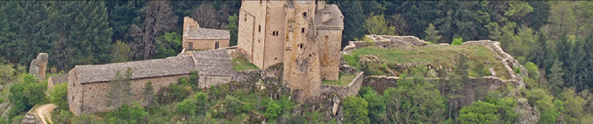
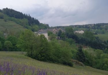
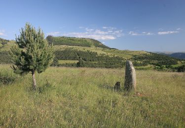
Le départ se situe à la sortie du hameau très encaissé de Ruas. Ce circuit, proche des mines d'uranium et de chaos rocheux, offre de beaux points de vue: vallée du Tarn et le château de Miral, les Bondons et le mont Lozère.

Elevation profile

Photos

Points of interest

Point of interest Les Bondons - DEPART RUAS - Photo
tracegps
LES BONDONS 
Point of interest Bédouès-Cocurès - PT VUE1 - Photo
tracegps
BÉDOUÈS-COCURÈS 

Positioning

Country:
France
Region :
Occitania
Department/Province :
Lozère
Municipality :
Les Bondons
Location:
Unknown
Start:(UTM)
552051 ; 4913844 (31T) N.

Comments

Please log in to post a review or rate the element


Trails nearby

Trail Walking Bédouès-Cocurès - Stevenson Bedouès Barre des Cévennes  - Photo
Walking
GUIDE
nadinebondoux

Walking

Difficult
Bédouès-Cocurès, Occitania, Lozère, France
20 km | 28 km-effort
6h 4min
No
Trail On foot Saint-Étienne-du-Valdonnez - Balade au pays des menhirs - Photo
On foot
PRO

On foot

Easy
Saint-Étienne-du-Valdonnez, Occitania, Lozère, France
5.5 km | 8 km-effort
1h 48min
Yes
Trail Walking Bédouès-Cocurès - 14-05-2023 E9 Bédouès - Barre des Cévennes  - Photo
Walking
GUIDE
Kargil

Walking

Very difficult
Bédouès-Cocurès, Occitania, Lozère, France
19.6 km | 27 km-effort
6h 11min
No
Trail Walking Les Bondons - les deux monts verts - Photo
Walking
lablaquiere

Walking

Medium
Les Bondons, Occitania, Lozère, France
6.8 km | 9.6 km-effort
2h 31min
Yes
Trail Walking Bédouès-Cocurès - Arpaon  - Photo
Walking
jeanjean35

Walking

Very difficult
Bédouès-Cocurès, Occitania, Lozère, France
13 km | 19.4 km-effort
4h 39min
No
Trail Walking Bédouès-Cocurès - Autour de Bédouès - Photo
Walking
phimar_2612

Walking

Medium
Bédouès-Cocurès, Occitania, Lozère, France
13.4 km | 19.8 km-effort
3h 48min
Yes
Trail Walking Pont de Montvert - Sud Mont Lozère - Grizac - La Lauze - Photo
Walking
nolsim

Walking

Difficult
Pont de Montvert - Sud Mont Lozère, Occitania, Lozère, France
27 km | 38 km-effort
7h 32min
No
Trail Walking Bédouès-Cocurès - BEDOUES/ SAINT GERMAIN DE GALBERTE - Photo
Walking
Michel DUBOIS

Walking

Difficult
Bédouès-Cocurès, Occitania, Lozère, France
37 km | 51 km-effort
11h 34min
No
Trail Walking Bédouès-Cocurès - 6e étape chemin de Stevenson - Photo
Walking
Melifera

Walking

Medium
Bédouès-Cocurès, Occitania, Lozère, France
41 km | 56 km-effort
9h 38min
No


Close
My subscriptions